Arthur Charles HUMPHRIES
Arthur Charles HUMPHRIES
New South Wales Police Force
Constable
Motor Vehicle Accident
Darlinghurst
7 April, 1925
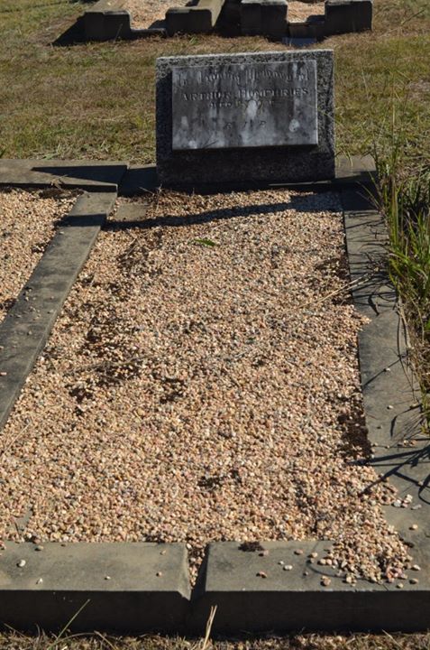
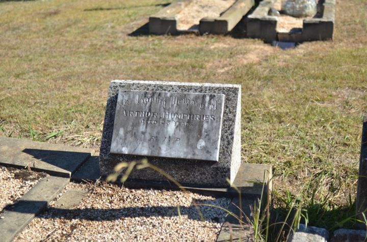
On Sunday 5 April, 1925 the constable was riding his motor cycle in Darlinghurst when the cycle collided with a brick wall at the intersection of Bourke and William Streets. He sustained a fractured skull and broken collar bone and was conveyed to the Sydney Hospital in a ( as reported in The Sydney Morning Herald ) critical condition but another newspaper article in the Singleton Argus, dated 11 April, states that he was treated and allowed to leave hospital to return home and that he was talking to a friend at 6pm when he collapsed and upon his second admission to hospital, it was discovered that he had a fractured skull.
He died on Monday, 6 April, 1925. It is not known if this death occurred on duty.
The Sydney Morning Herald dated 6 April, 1925 reported that “Severe injuries were sustained by Arthur Charles Humphries aged 23 years, a police constable stationed at Darlinghurst, who resides at 20 Hoddle Street, Paddington, when he lost control of his motor cycle yesterday and was thrown against a brick wall. The injured constable was riding the cycle in Bourke Street, East Sydney. He was thrown with great force against the wall, and suffered a fractured skull and a fractured collarbone. He was taken to Sydney Hospital where his condition last night was reported to be extremely critical.”
The NSW Register of Coroners Inquests and Magisterial Inquiries, 1834-1942 indicates that an inquest was held into the constable’s death at the Sydney City Coroner’s Court on 14 April, 1925 where it was found that the death was caused from “injuries accidentally received through being thrown from his motorcycle.”
The constable was born in Goulburn in 1903 and at the time of his death was stationed at Darlinghurst.
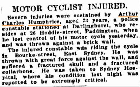
Monday 6 April 1925
page 12 of 20
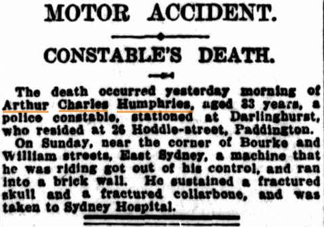
Tuesday 7 April 1925
page 11 of 20
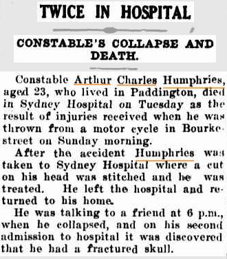
Saturday 11 April 1925
page 6 of 8
Location of Grave:
[google-map-v3 shortcodeid=”a8086026″ width=”350″ height=”350″ zoom=”12″ maptype=”roadmap” mapalign=”center” directionhint=”false” language=”default” poweredby=”false” maptypecontrol=”true” pancontrol=”true” zoomcontrol=”true” scalecontrol=”true” streetviewcontrol=”true” scrollwheelcontrol=”false” draggable=”true” tiltfourtyfive=”false” enablegeolocationmarker=”true” enablemarkerclustering=”false” addmarkermashup=”false” addmarkermashupbubble=”false” addmarkerlist=”-34.914981, 149.430336{}5-default.png{}Grave site” bubbleautopan=”true” distanceunits=”km” showbike=”false” showtraffic=”false” showpanoramio=”false”]
